
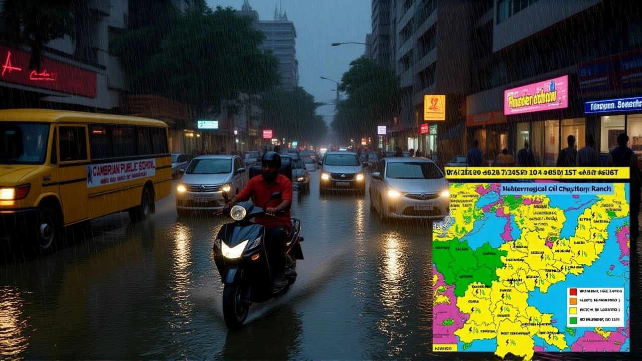
On October 5, 2025, the Indian Meteorological Department issued a yellow alert for lightning and gusty winds across a broad stretch of Madhya Pradesh, covering more than 50 districts including Bhopal and Indore. While heavy rain is off the table for the day, residents are being warned to expect sudden thunderstorms, bright flashes, and wind speeds that could topple weak structures.
Current Weather Outlook for Madhya Pradesh
The department’s forecast shows scattered showers in the northern districts but essentially dry conditions in the central and southern regions. However, the real threat comes from electrical activity: the agency expects up to 15 lightning strikes per hour in the most affected zones, with wind gusts reaching 45‑55 km/h. Cities such as Ujjain, Sagar, Rewa and Chhindwara are also under the alert. The warning will stay active until the evening, after which the department will reassess based on real‑time data.
Underlying Weather Systems
Two major atmospheric features are driving today’s conditions. First, the south‑west monsoon’s return line is nudging north‑eastward, threading through the foothills of Baruch, Ujjain, Jhansi and Shahjahanpur. This weak monsoon edge is enough to destabilise the lower troposphere, sparking thunderstorm cells without the deluge usually associated with monsoon rains.
Second, a new western disturbance is expected to move into north‑western India later in the day. Western DisturbanceNorthwest India typically brings cooler, moisture‑laden air from the Mediterranean. In this case, it’s merging with the monsoon fringe, amplifying instability and creating the perfect recipe for lightning‑laden thunderstorms.
Regional Influences: Shakti Cyclone and Adjacent States
While Madhya Pradesh wrestles with its own alerts, the Arabian Sea hosts Shakti, a cyclone that’s been churning roughly 470 km west of Dwaraka, Gujarat. The system, once a deep depression, has intensified into a severe low‑pressure area that could spill moisture northward, indirectly supporting the western disturbance.
In neighboring Odisha, the deep depression that lingered over the Bay of Bengal has weakened into a normal depression, easing the heavy rains that previously battered the state. Nonetheless, the gradual shift in pressure patterns is funneling more moisture toward the north‑east, nudging light showers into parts of Jharkhand, Bihar and Chhattisgarh.
Expert Advice and Public Safety Measures
"People should keep an eye on the sky, especially during late afternoon," said Dr. Anjali Mehta, a senior meteorologist at the department. "If you hear thunder, stay indoors. Unplug sensitive electronics and avoid standing near tall trees or metal structures. Even a brief flash can be deadly in a yellow‑alert scenario."
Local authorities in Bhopal have dispatched additional teams to clear debris from power lines and have urged schools to keep children inside until the evening. Emergency services in Indore are on standby, and the municipal corporation has issued a reminder to secure loose objects in public markets.
What the Forecast Means for Residents
For most urban dwellers, the day will feel like a typical October morning—cool, dry, and clear—until the late afternoon when clouds roll in and the first crack of thunder echoes. Farmers in the Malwa region, especially around the Shajapur district, should be prepared for sudden downpours that could damage crops not yet harvested.
Travelers heading to hill stations like Pachmarhi should watch for reduced visibility on winding roads. Pilots flying in and out of the Bhopal airport have been advised to expect brief interruptions, and some low‑cost airlines have pre‑emptively added buffer time to flight schedules.
Looking Ahead: Upcoming Weather Patterns
The department’s extended outlook shows a likely intensification of the western disturbance over the next 48 hours, potentially bringing moderate rain to northern Madhya Pradesh and adjoining Uttar Pradesh. By October 8, the monsoon retreat line is expected to stall, meaning the risk of heavy rain remains low for the core of the state.
However, as the Shakti cyclone drifts westward, its outer bands could brush the Gujarat coastline, prompting another set of alerts for that region. Residents of the coastal districts are advised to stay tuned to local bulletins.
Frequently Asked Questions
What exactly does a yellow alert mean for residents?
A yellow alert signals heightened risk of lightning and strong winds but not an imminent severe storm. It urges people to stay indoors during thunder, secure loose objects, and avoid outdoor activities in exposed areas.
Which districts in Madhya Pradesh are most affected?
The alert covers roughly 50 districts, with the highest concentration in Bhopal, Indore, Ujjain, Sagar, Rewa, and Chhindwara. Rural blocks around Shajapur and the Malwa plateau also face intermittent thunderstorms.
How is the Shakti cyclone influencing Madhya Pradesh’s weather?
Although the cyclone remains over the Arabian Sea, its circulation is feeding moisture into the western disturbance. That extra moisture amplifies atmospheric instability, making lightning more likely over central India.
When can people expect the alert to be lifted?
Officials will review conditions at sunset on October 5. If lightning activity subsides and wind speeds drop below 30 km/h, the yellow alert could be canceled by early evening.
What should farmers do to protect their crops?
Farmers should shelter seedlings in shade nets, secure irrigation equipment, and postpone pesticide spraying until after the storm window passes, as sudden downpours can wash away topsoil.